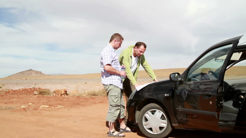
Most of us on this site have enough years behind us to remember pulling over to spread the huge road map on the hood of the car and figure where we turned wrong. (The correct answer was Albuquerque.) If it wasn’t us, it was our parents. Then the arguing ensued.
Today’s road trips are fraught with the same battles, but what the young drivers of today fail to appreciate is “you are here” feature found on smartphone GPS systems. In fact, it hasn’t been that long that our phones had GPS ability.
The advent of GPS has been the single greatest contribution to road trips, next to the actual phones we use to geolocate ourselves. We can thank the U.S. military for all this convenience.
Sputnik
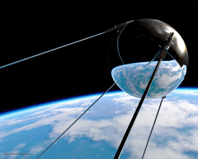
Days after the Soviets launched Sputnik 1, the first Earth-orbiting satellite, two U.S. physicists discussed tracking Sputnik. It was October 1957.
The pair of physicists were able to locate and track the little satellite from its radio signal, giving birth to an idea: the Transit system. They believed they could engineer a system designed to leverage this technology for global positioning.
By 1960 they had a satellite in orbit. More satellites followed.
The first functioning version a global positioning system leveraged ten satellites orbiting Earth’s poles. Navy submarines, by observing the changing position of the satellites in relationship to their vessels using Doppler, were able to geolocate themselves in minutes.
This was game-changing research for subs at the time. Prior to this, their options for navigating were via sonar or surfacing to use of various radio or even celestial navigation systems.
All of these options had their limitations, but with a satellite-based system, they could stay down and evade detection better.
Department of Defense
Transit satellite | timeandnavigation.si.edu
The Navy’s Transit system inspired the Department of Defense (DoD) to create a more robust satellite system. The Transit system suffered limitations, namely precision, and coverage.
The decision to launch was in the early 1970s. As motivation, the Soviets had already followed our lead at that point, launching their own satellite system for navigation. We had to stay ahead of them where it mattered.
If we could launch a more effective global system, we could control the world in a way. The plan was to make the system available to anyone with access once it was up. We would also control that access as needed, turning off whole countries as needed.
Other countries would have to face the costs of duplicating that system or playing nicely with us.
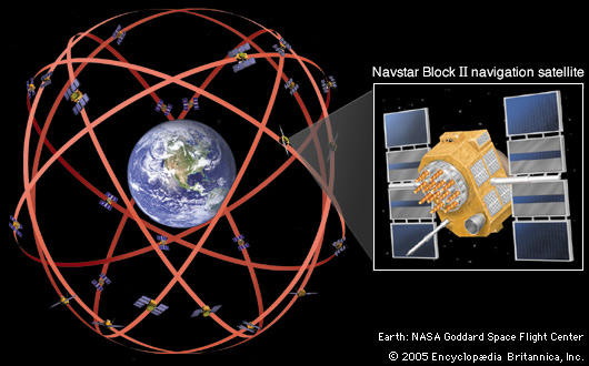
Instead of a few satellites, the DoD would launch 24 of them. Starting in 1978, they began building what they called the Navigation System with Timing and Ranging (NAVSTAR).
The coverage of those satellites would give us navigation accuracy within 16-feet. This would come in handy as we developed intercontinental ballistic missiles.
End of Paper Maps
The Navstar program was successful and the writing was on the wall. The days of the paper map were numbered.
Soon, dads everywhere would not have to pull over at gas stations to “figure out where the heck we are.” They’d have in-dash systems to tell them where and redirect them as necessary.
In the long run, we launched 32 total GPS satellites. By 1995, the system was online and fully functional. Since that time, the U.S. has initiated upgrades to GPS, the most recent being in 2000 with the GPS III program.
The Russians were smart enough to launch their own version of GPS, called GLONASS, lest they’d have to negotiate with the Americans for access to GPS. Europe and China also have systems in place.
The time-honored tradition of pulling over isn’t dead. We still pull over for snacks, but we no longer have to waste time figuring out the directions. Kids today will never appreciate what we lived through.
Meh… some traditions were meant to expire.